Sentry integrates automated multi-constellation tasking orchestration, real-time data fusion and AI-driven analytics to monitor hundreds of sites around the world and unlock decision superiority
WESTMINSTER, Colo–(BUSINESS WIRE)–Maxar Intelligence, the leading provider of secure, precise geospatial insights, today announced the launch of Sentry™, a first-of-its-kind persistent monitoring solution that delivers strategic operational and threat intelligence at global scale for a real-time decision advantage.

Sentry integrates AI-powered capabilities unique to Maxar—including multi-source constellation orchestration, geospatial fusion, and advanced machine learning models for automated analytics—to deliver a new level of closed-loop spatial intelligence. It is specifically designed to monitor hundreds of areas around the world to solve complex problems such as anticipating adversarial threats or protecting industrial infrastructure.
The Sentry suite includes two products designed for specific mission sets:
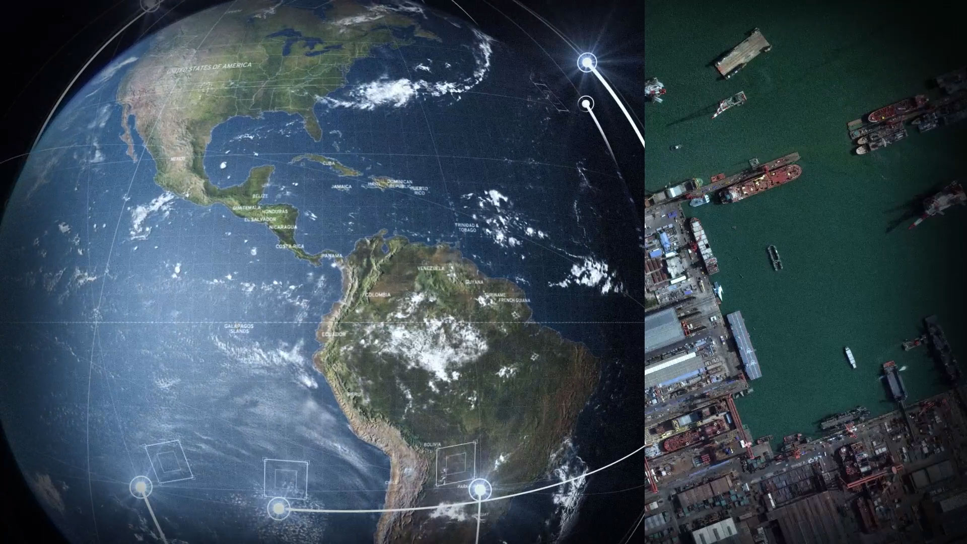
- Site Sentry, a product for monitoring places of interest across land and sea, such as shipyards, airports, urban centers and more.
- Maritime Sentry, a broad area monitoring product for tracking vessel activity at sea and in port, enabling customers to actively monitor thousands of sq km of ocean at once.
Both Sentry products draw on Maxar’s 250+ petabyte archive of very high-resolution satellite imagery collected over more than two decades. This unrivaled geospatial foundation provides training data for advanced AI/ML computer vision models that contain a detailed understanding of historical activity and global patterns across the world.
“For many of our customers, it’s no longer enough to be able to deliver persistent monitoring of only one or two sites or limited geographies—the world is changing too fast, and they need to be able to identify mission-critical activity before it happens, anywhere in the world,” said Dan Smoot, CEO of Maxar Intelligence. “For the first time, Sentry makes it possible to use the full potential of space to deliver predictive intelligence at global scale. Sentry uses AI and ML to drive automation across the entire sensor-to-decision system, unlocking sensor integration at a scale that hasn’t been done before.”
“It’s a game changer for our customer that unlocks a new level of decision superiority, be it to identify an imminent satellite launch before it happens or to estimate potential threats to energy infrastructure following a natural disaster,” continued Smoot.
Sentry is built around three core automation-powered technologies:
- Tasking: Maxar’s proprietary collection orchestration software automatically integrates feasibility and tasking scheduling processes across commercial and sovereign satellite constellations, including electro-optical and synthetic aperture radar (SAR) satellites, dramatically increasing the number of sites that can be monitored simultaneously.
- Production: Maxar’s automated geospatial production and fusion capabilities transform the data collected from various sensors into a dynamic representation of the globe that is fully co-registered and prepared for analysis at scale.
- Analytics: Maxar utilizes object detection models as well as third-party systems to identify signals about mission-relevant activity and patterns. These insights can then be delivered directly to the analyst or decision-maker through Maxar’s Insights UI app or to a customer’s secure environment via API.
Sentry: Delivering proven capability for the world’s toughest missions
Several of the technologies used to build Sentry were successfully demonstrated in existing programs supporting U.S. intelligence and defense missions.
For example, as part of its execution on the National Geospatial-Intelligence Agency’s (NGA) Luno A D01 task order, Maxar used geospatial fusion and analytics technologies to deliver AI/ML-generated object detections across numerous specified locations within hours of image acquisition. These capabilities enabled rapid identification of aircraft, ships, vehicles and railcars, object counts and classification—laying the groundwork for identifying trends and anomalies. This work also directly informed the development of Sentry.
To learn more about Sentry, visit www.maxar.com/sentry.
About Maxar Intelligence
Maxar Intelligence is a leading provider of secure, precise geospatial insights. Operating the most advanced commercial Earth observation constellation on orbit, we use the power of very high-resolution satellite imagery and software technology to deliver mission success on Earth and in space. Our secure, AI-powered products and services deliver ground truth in near real-time to keep nations safe, improve navigation, protect our planet, speed up disaster response and more. For more information, visit www.maxar.com.
Contacts
Media Contact:
Tomi Maxted
Maxar Intelligence
Tomi.maxted@maxar.com